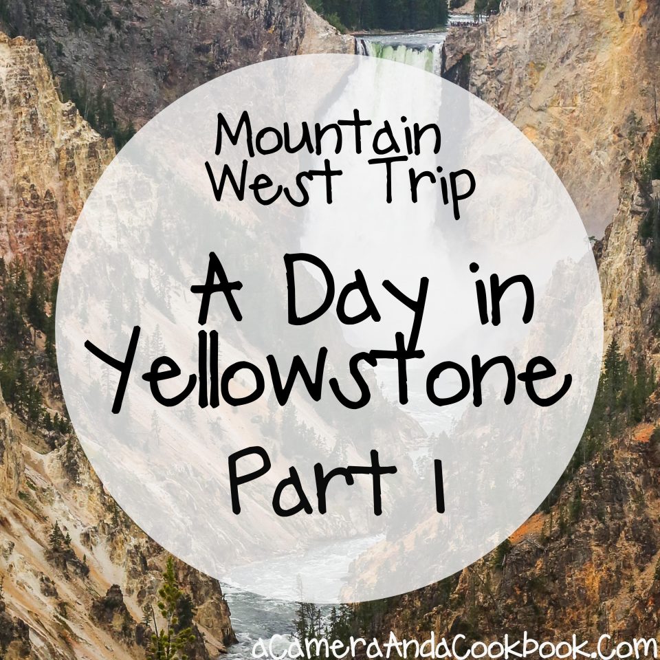
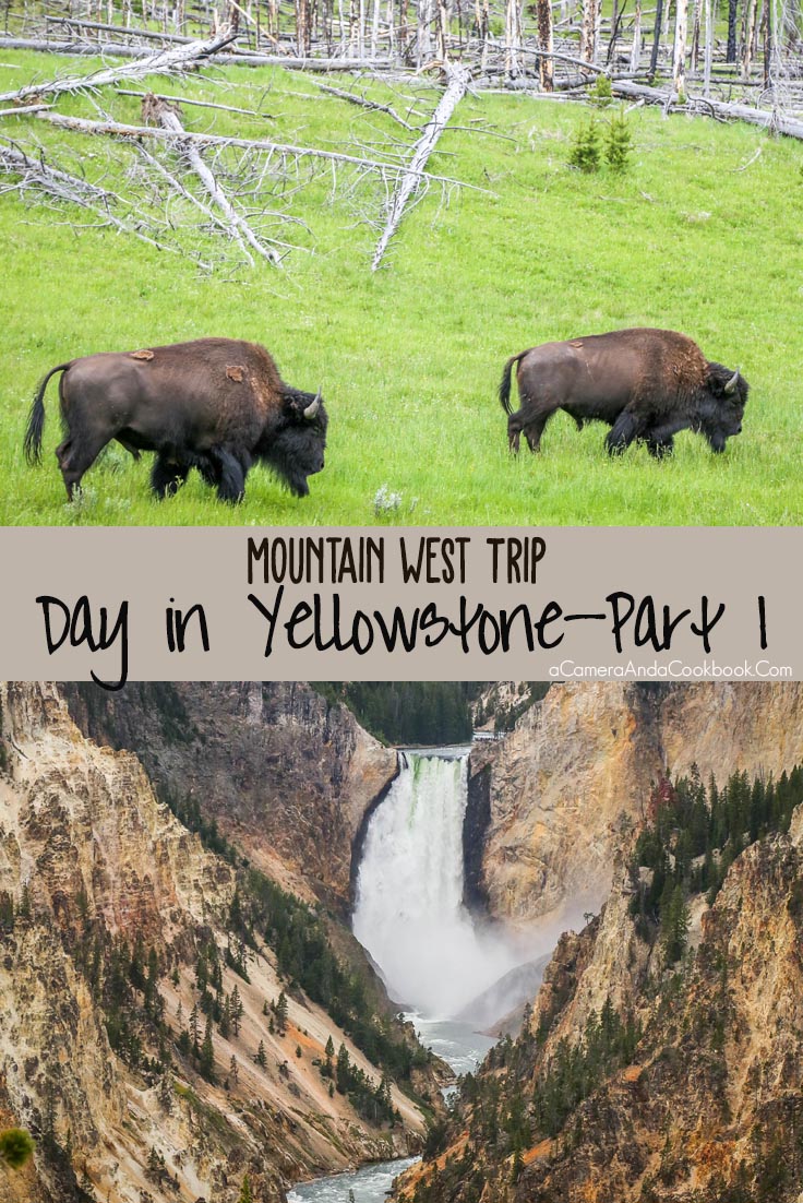
If you missed my first few posts from our Mountain West Trip you can see those listed here. This post is from the 1st half of our epic day in Yellowstone with so many amazing sights, which means so many pictures to share. From traffic jams caused by bison crossing the road to geysers and hot springs.
In this post, I’ve added some GPS coordinates and linked them to Google Maps. I kinda wished I’d done that previous travel posts, but never thought it would be that important. My Canon EOS 6D DSLR Camera has a built in GPS which gives me this info. Hope you find it useful.
On the morning of our big day, we got up, grabbed breakfast at the hotel, and raced out to the nearest Walmart on the way, because we thought about the fact, we had really no snacks or water with us and we knew food options would be sparse. We had spent the night in Cody, WY at the Roadway Inn 1919 17th Street, Cody, WY, 82414
We were about 2.5 miles from the nearest Walmart, which was there in Cody. We got a few bags of snacks and drinks to help us get through the next couple of days of National Parks. Then it was off to Yellowstone, which was 62 miles away. If you drive it without stopping just about an hour and 20 minutes from Cody, WY. However, we made a couple stops before we even entered the park. One stop at Buffalo Bill Dam and Chimney Rock, where I had to pee so bad that I actually went in hidden spot, squatted, and on we went. Sorry TMI. Just not something I normally do.
These pics are all near the dam.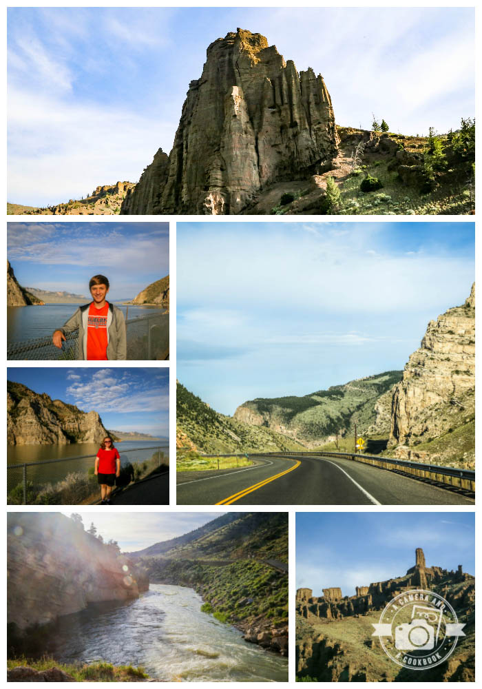
The pictures don’t do this justice, but this is Chimney Rock 44°27’14.346″ N 109°48’53.568″ W.
44°27’56.844″ N 109°39’14.928″ W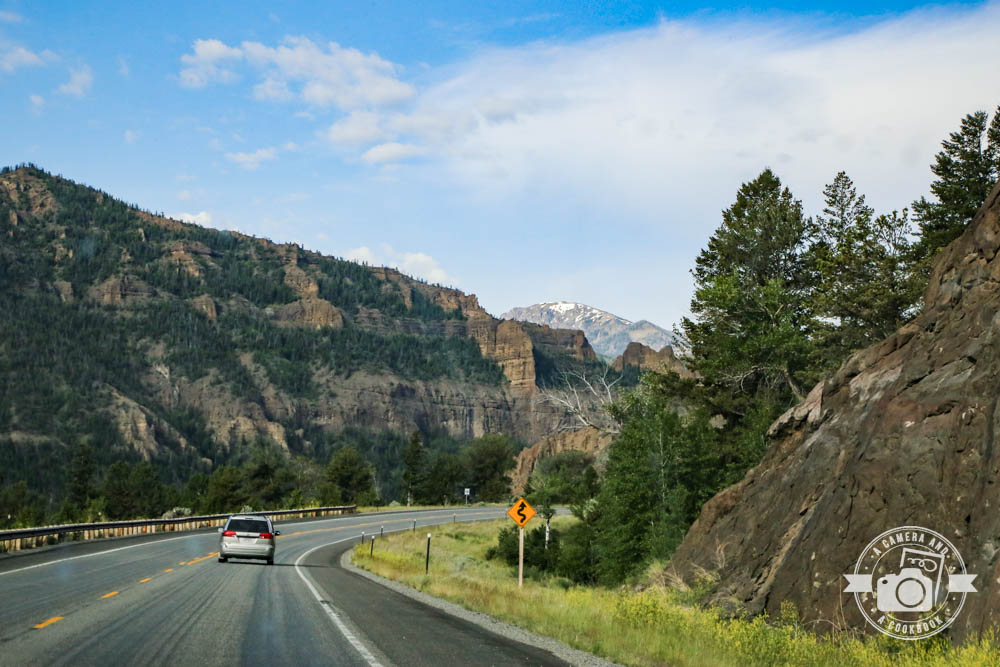
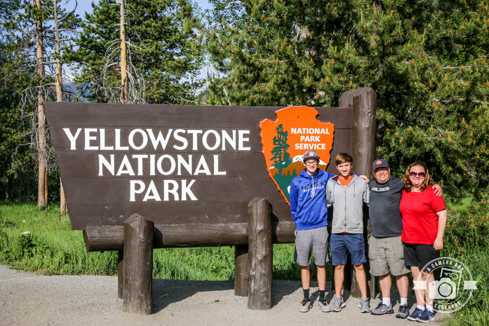
Here’s the entrance along with some views right after entering the park.
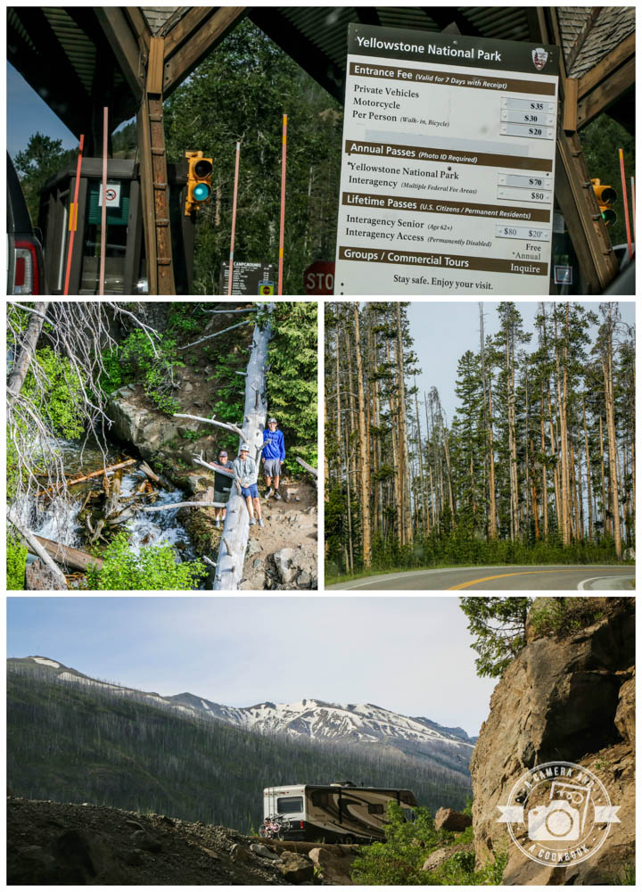
It’s $35 a car to get in. However we got the US Park Pass earlier in the year, because we went to several National Parks throughout the year. So we got in for free.
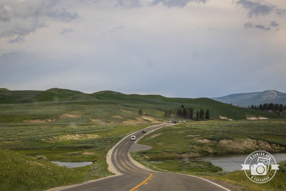
Since we were coming in from Cody, WY, we entered through the East Entrance and decided to North (turning right) so that maybe by the time we got to Old Faithful the crowds would have died down instead of hitting it earlier in the day. Part 1 is highlighted in Yellow. Part 2 is in Blue.
 Click map to see larger view. You can click again to zoom in even more. (Original Map Courtesy of https://yellowstone.net/)
We highly recommend the GyPSy Guide App. We did the Yellowstone/Teton Combo for $10 since the next day we’d be driving through the Tetons. This is an audio tour app that you download on your phone and bluetooth through your car radio so everyone can hear it. I think for us we stopped at a lot more spots because he explains why it you might want to stop. This helped us decide better because there are lots of places to stop along the route. A lot of stops we got out snapped a few pics and moved on. Other stops we might take more time to walk the paths, which I’ll cover later in the post. This app is worth every penny! The only issue we had was because of the way our rental car radio worked. We had to reconnect after almost every time we turned the car off.
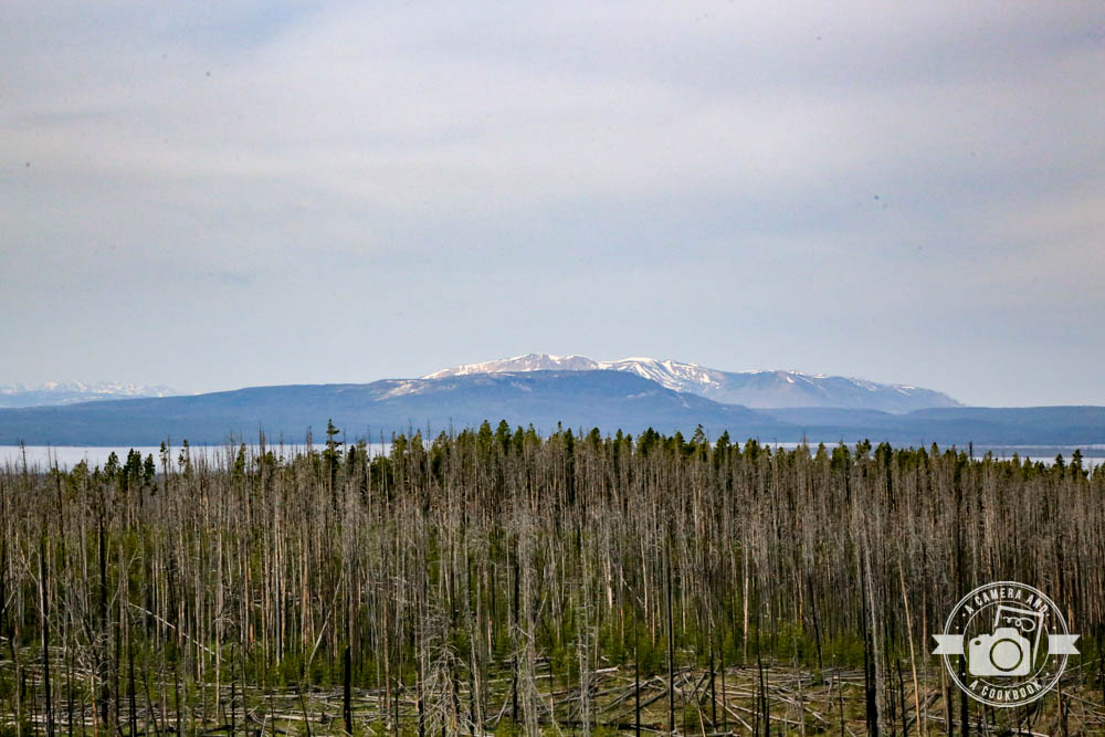
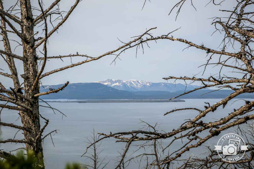
Views from Lake Butte Overlook (44°30’16.29″ N 110°14’27.126″ W)
Steamboat Point (44°31’9.81″ N 110°16’38.316″ W) on the east shore of Yellowstone Lake. This was our first look at small vents and signs of warning to keep off thermal areas.
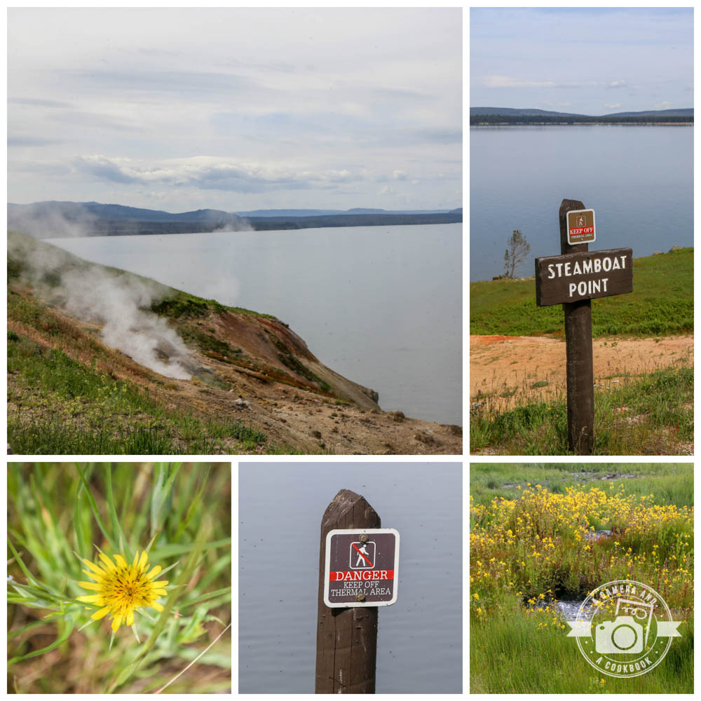
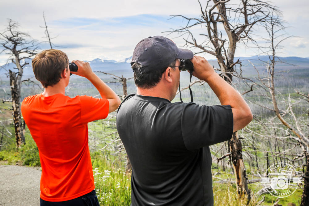
44°30’36.804″ N 110°16’30.744″ W – I love this shot! Reminder: Bring your binoculars!
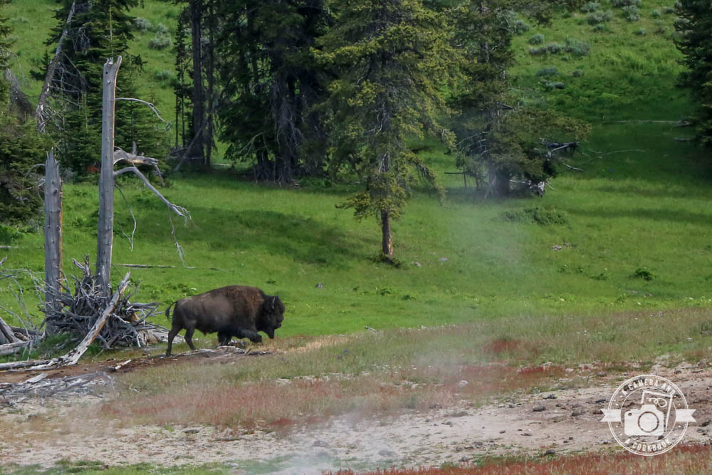
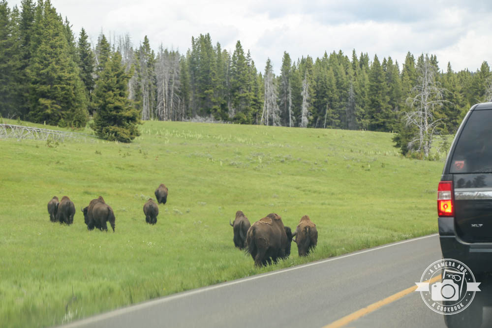
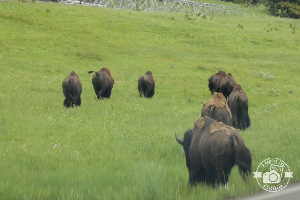
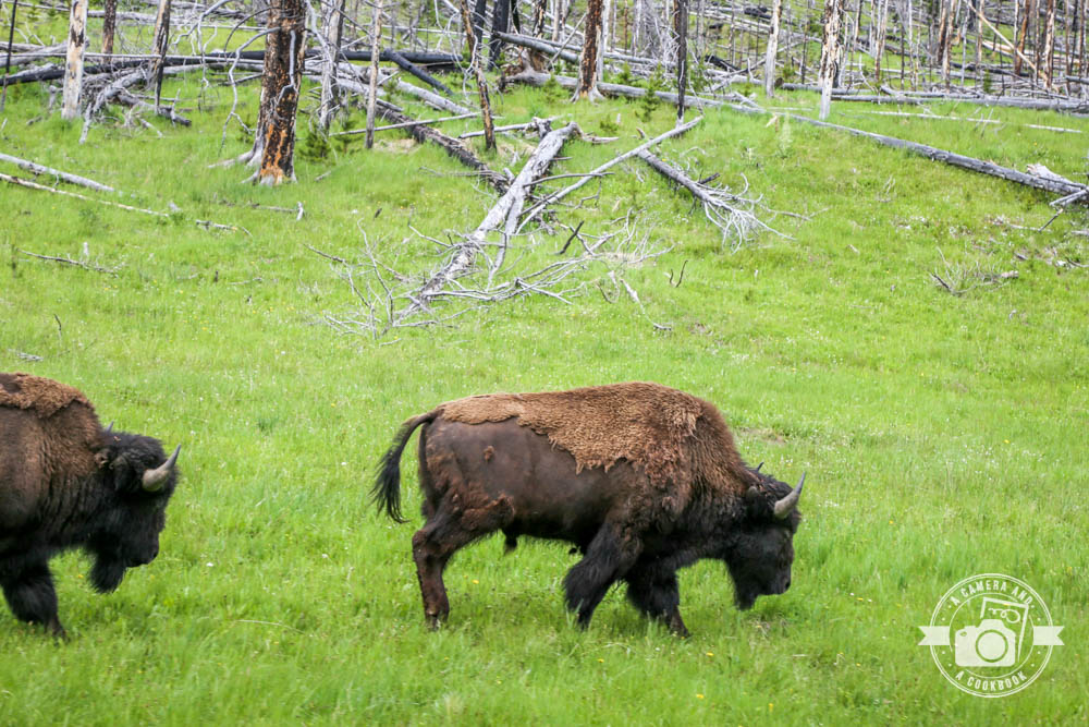
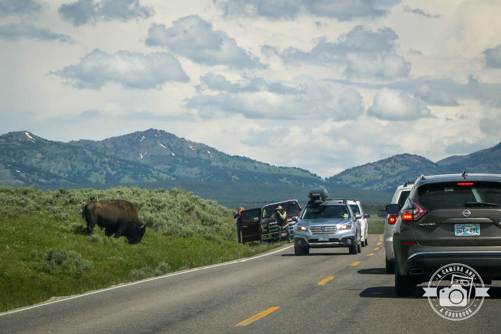
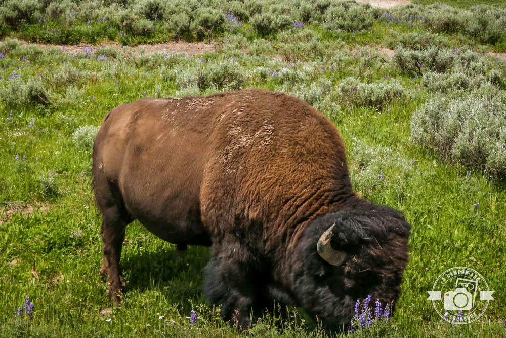
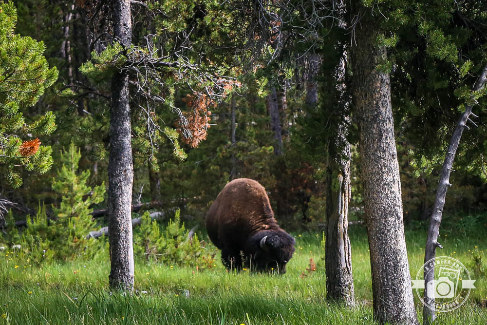
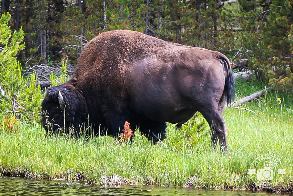
We sat in traffic for a good 30 minutes waiting for Bison to pass. Here’s when we finally got to see them. 44°35’45.156″ N 110°23’15.282″ W
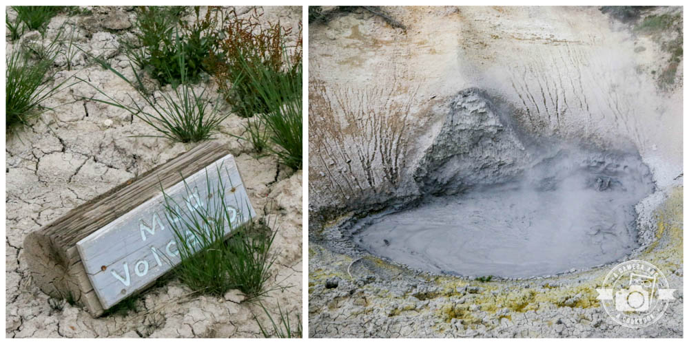
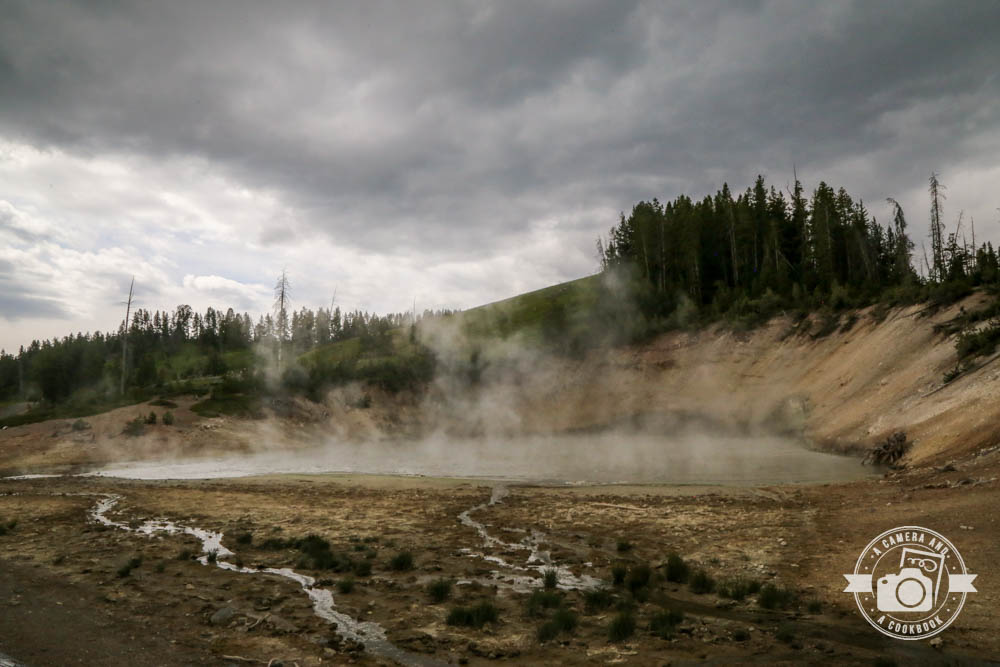
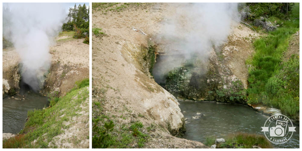
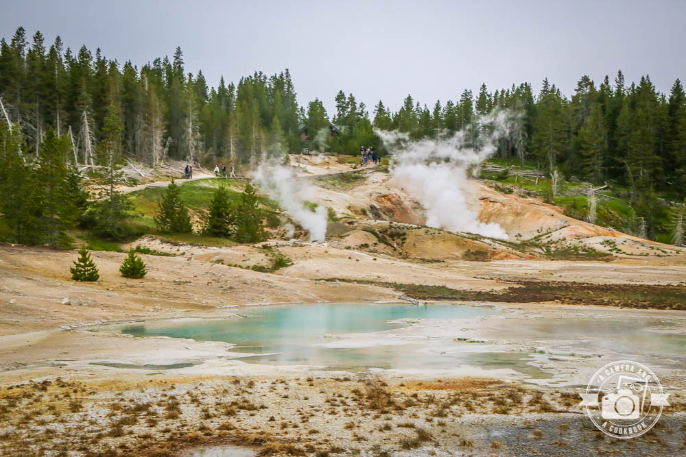
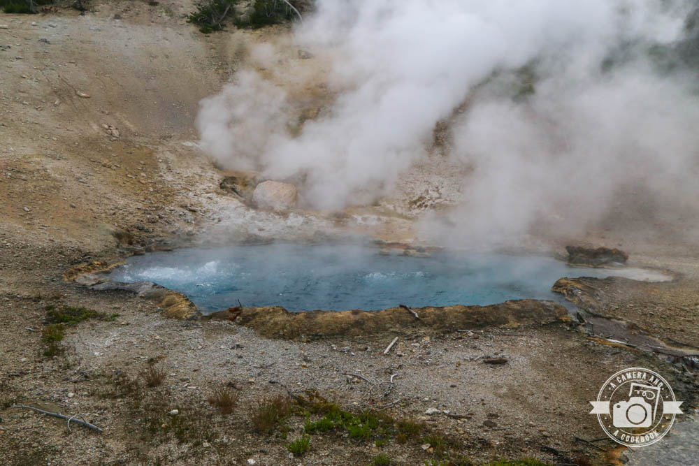
Mud Volcano Thermal Area has muddy hot springs and fumaroles (an opening in or near a volcano, through which hot sulfurous gases emerge) located near Yellowstone Volcano’s vents.
You can see the Mud Cauldron from the pathway right in front of the parking area. This is a large area of mud and water that is heated by steam which escapes from deep in the ground.
Black Dragon Cauldron is a large, sizzling lake of mud. 44°37’30.228″ N 110°26’5.514″ W
On the left of the parking log is bit of a steep climb. However before the climb begins, there’s a short side path that leads to the Mud Geyser. Back in the 1800’s, this feature used to shoot muddy water up to 50 feet in the air! Now it’s just a boiling mudpot area.
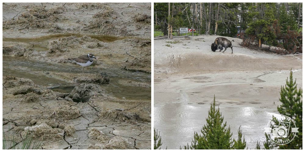
We couldn’t walk up to the Grizzly Fumarole area because of the Bison that decided to have brunch near there. Of course people were getting way too close, so one of the park rangers had to yell out that them get back.
Just a short walk down from Mud Volcano, there’s a boardwalk which leads to the Dragon’s Mouth Spring. This is one of the most interesting features of this area. Here you’ll see a small cave like opening that appears to be exhaling a heavy steam. When you listen carefully it sounds as though the “dragon within” is talking.
Just down the road from the Mud Volcano Thermal Area is more open road. 44°37’47.118″ N 110°26’17.034″ W
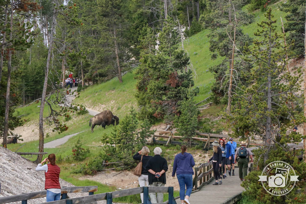
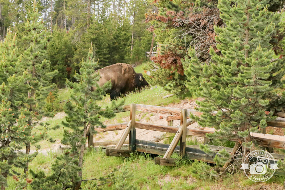
Then we saw these crazy folks which were causing a traffic jam. Way too close!
This is the pic I got while just driving by.
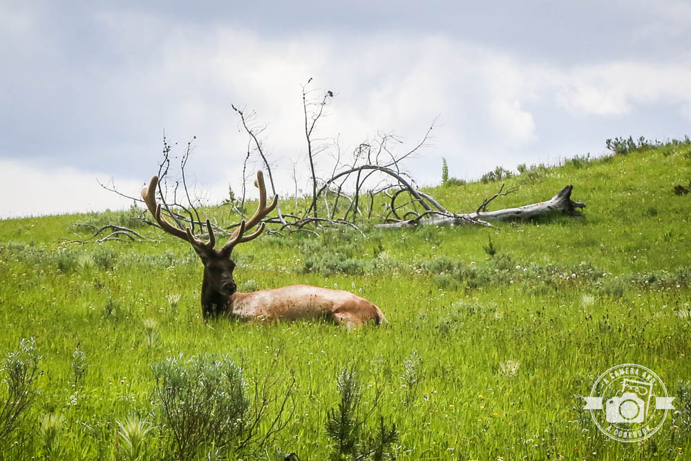
Not too far from Alum Creek Trailhead we saw a bunch of cars pulled over on the side of the road and people getting out. We were curious so we went behind a large group of trees and saw this guy hanging out. He had a friend not to far form him as well, but I couldn’t get a clear shot of him because he was hidden behind some dead limbs. 44°40’55.674″ N 110°29’34.434″ W
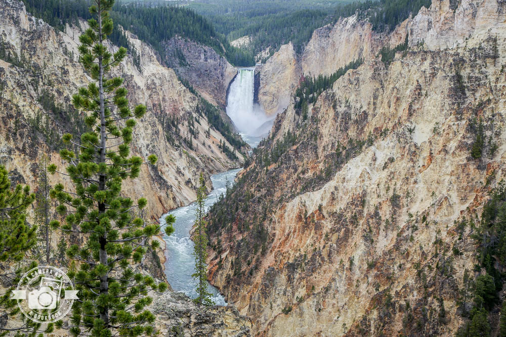
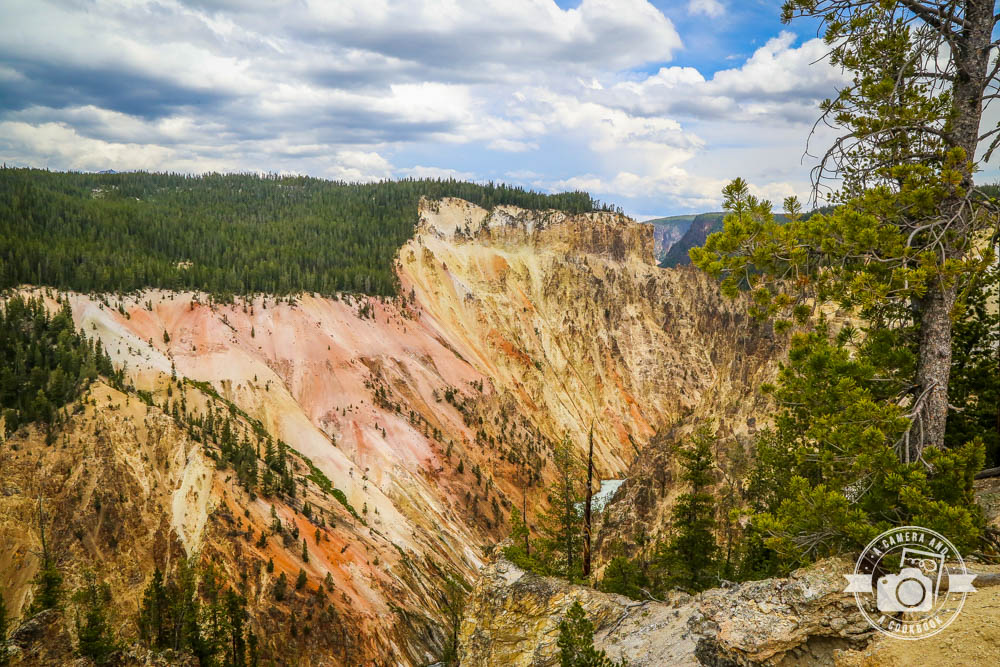
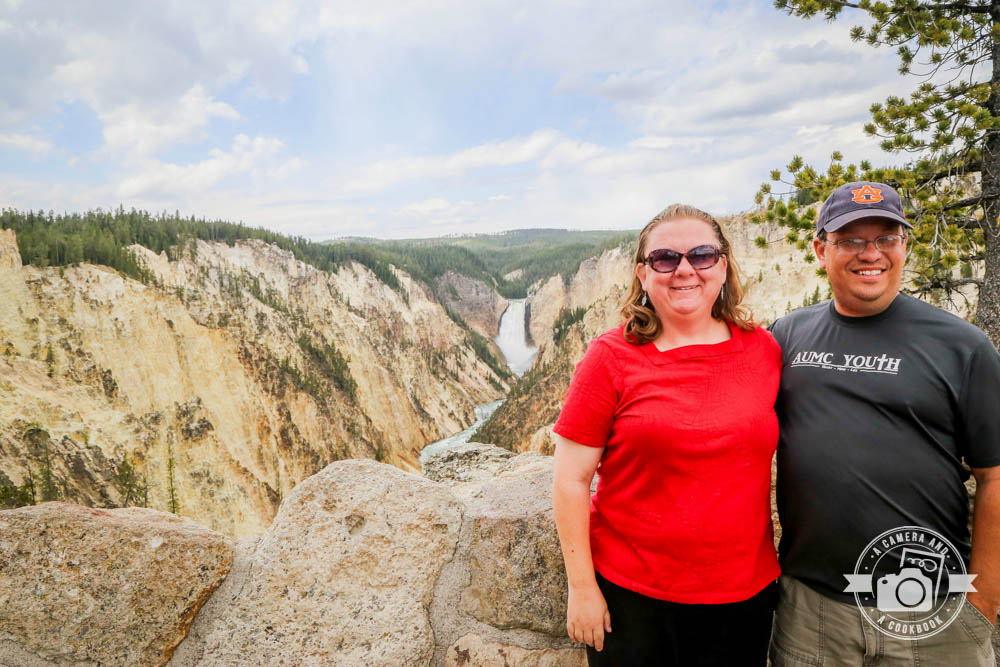
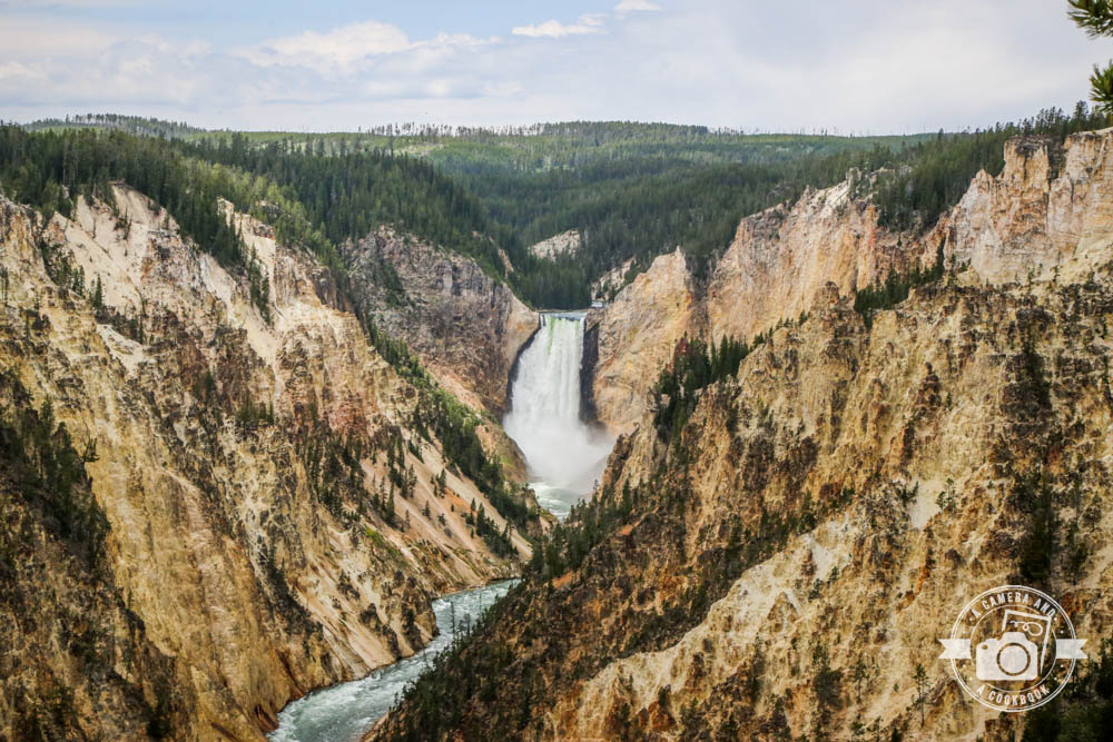
Next stop was Artist Point. This was on Rob’s must see list.
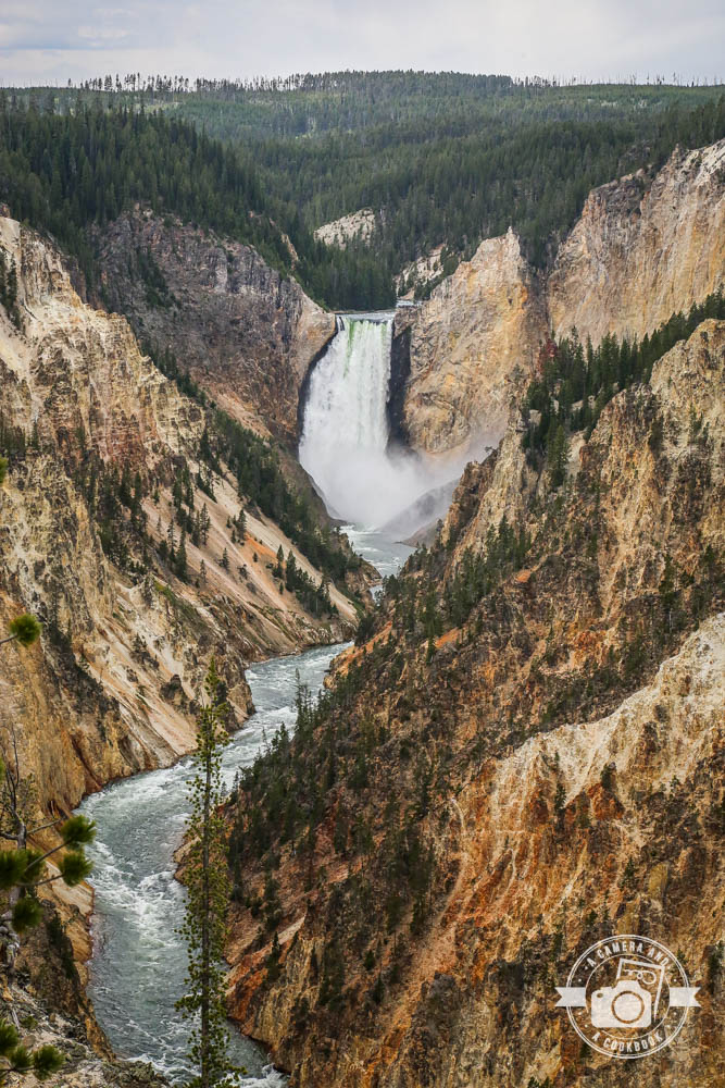
This is the “Grand Canyon” of Yellowstone. About 20 miles long, which measures from the Upper Fall to the Tower Fall area.

The Grand Canyon of the Yellowstone is roughly 20 miles long, measured from the Upper Falls to the Tower Fall area. The canyon was formed by erosion from the Yellowstone River flowing through.
All of my pictures are taken from Artist Point of the 308 foot drop at Lower Falls. There is the Upper Falls that drops 109 feet seen from a couple other locations
At this point we were getting hungry and we saw signs to Yellowstone Canyon Village with a food sign. We ended up in the Canyon General Store, where they have a decent size grocery store as well as a diner that serves burger, fries, shakes, etc. There was no hope of us sitting down there, so we ordered at the kiosk and took it to go. We probably waited 10-15 minutes. I stood there and waited for them to call our order, while the boys walked into the grocery part of the building and got drinks. We took it outside and were lucky enough to find a picnic table open where we sat and ate.
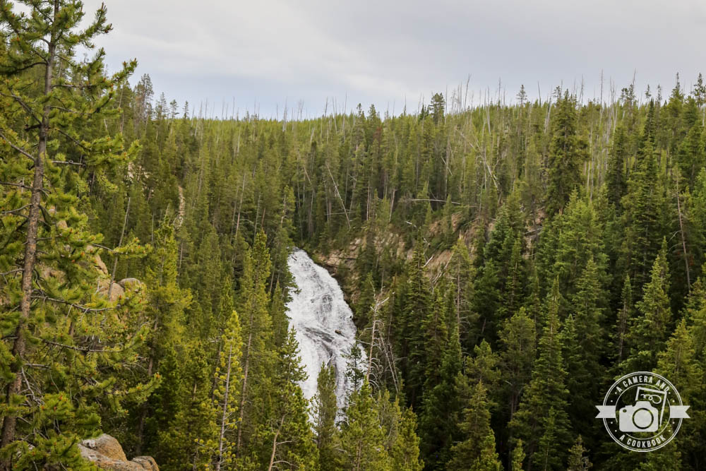
We took the side road to see Virginia Cascades. At a 60 foot gradual slope into a deep canyon, it’s pretty impressive. The falls aren’t fall far off the road, but there’s only a couple place to park.
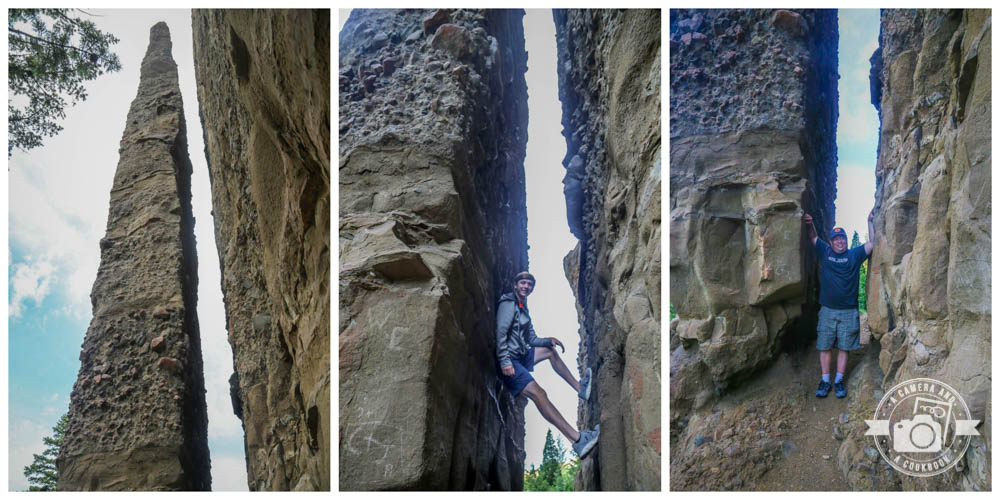
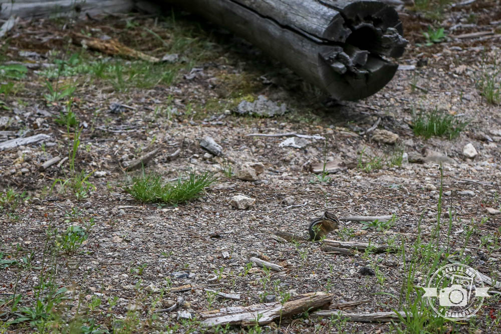
Don’t want to leave out the little guys.
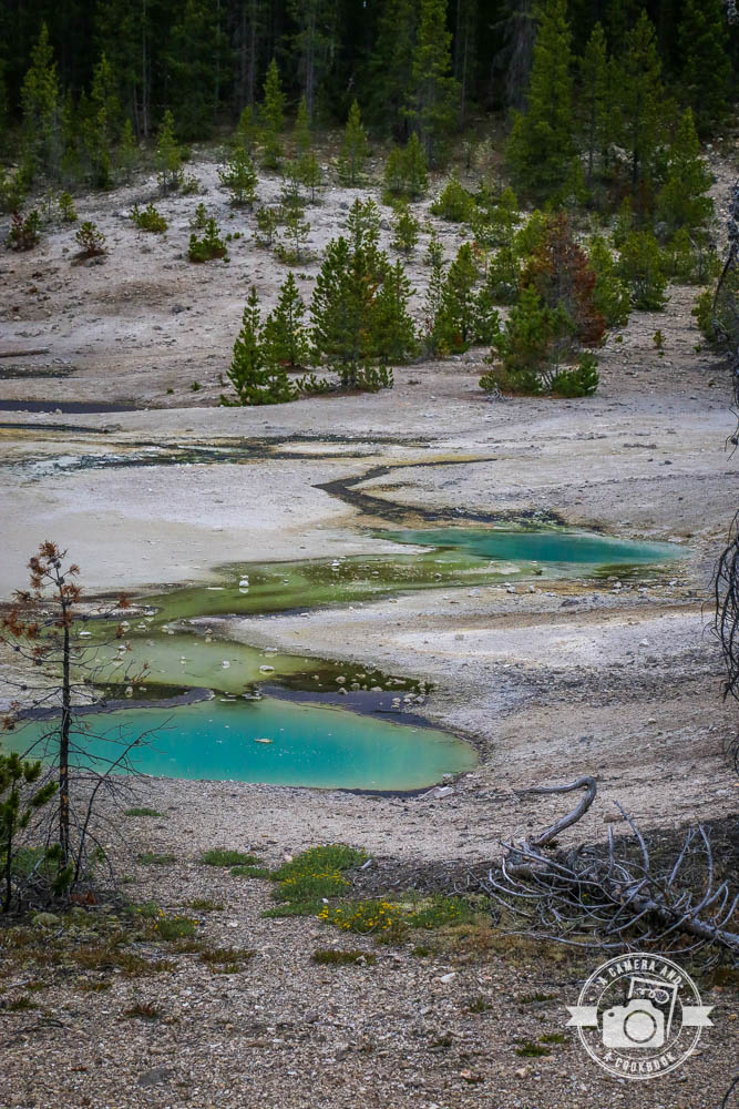
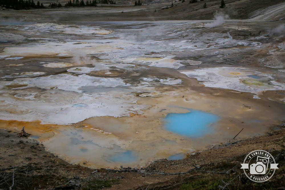
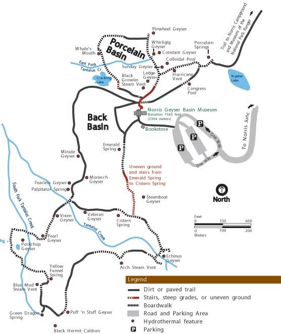
Norris Geyser Basin
The view as you enter the boardwalk area at Norris Geyser Basin after walking through the museum. Norris Geyser Basin is the hottest and most changeable thermal area in Yellowstone. If you walk the entire area you go about 2 1/4 miles (3.6 km) of trails. map
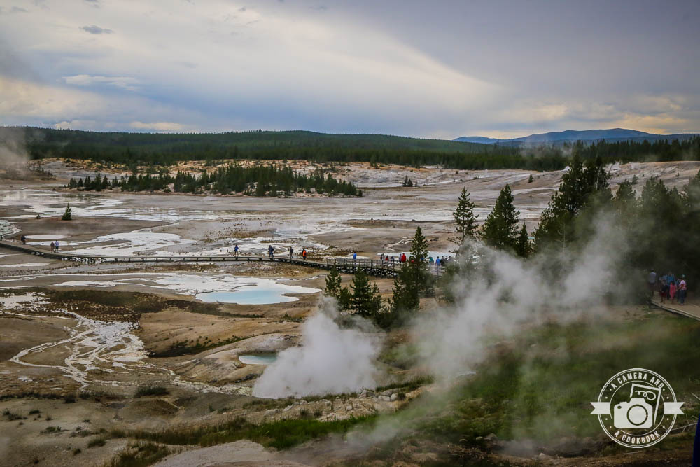
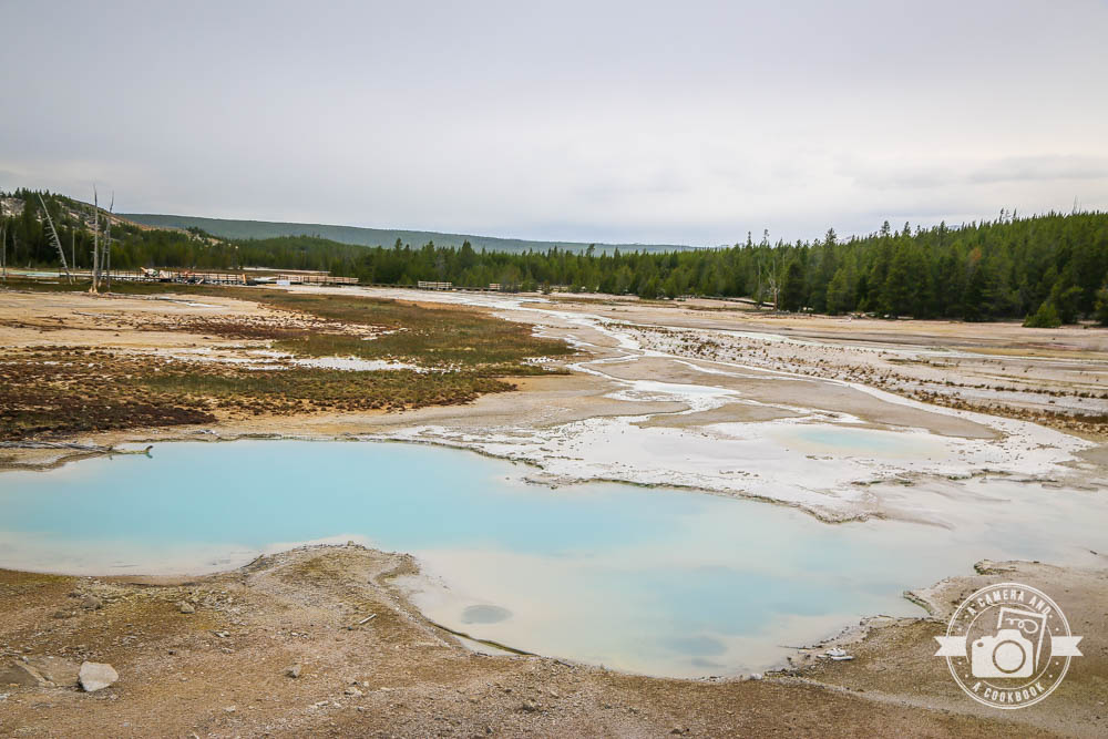
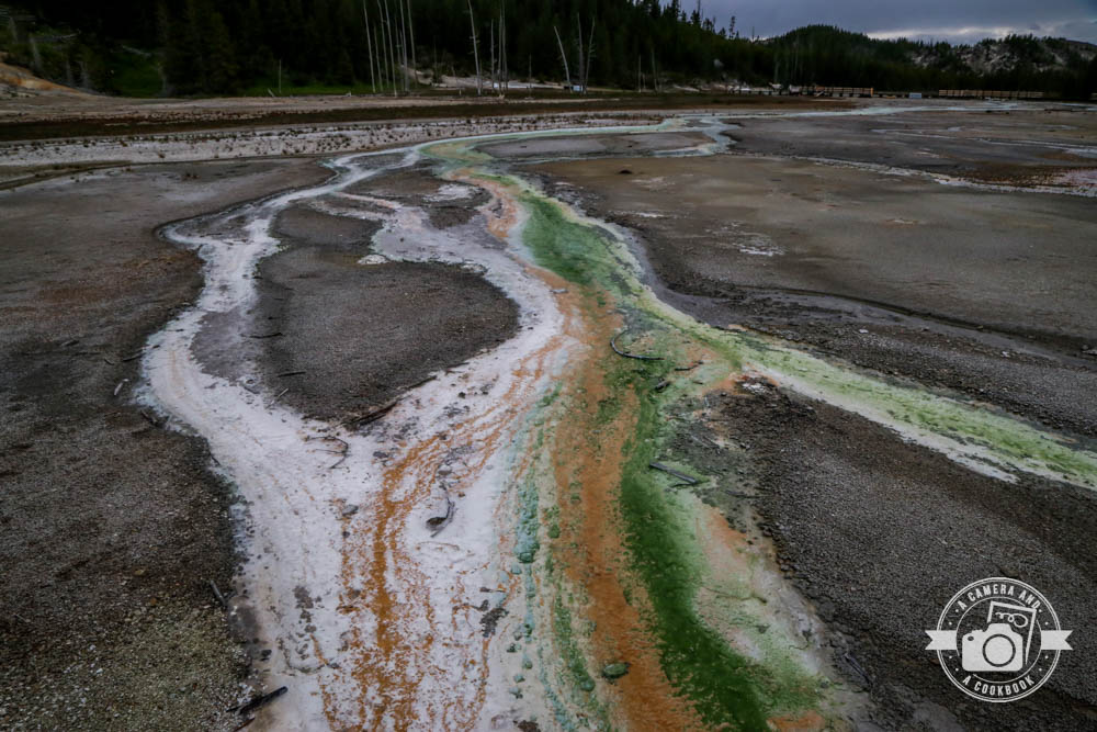
Porcelain Basin is to the right of the museum. This area is smaller area with more dense features including Hurricane Vent (pictured below), Pinwheel Geyser, and lots more.
Here’s just a few more pics from the Porcelain Basin area.
44°43’42.108″ N 110°42’1.914″ W
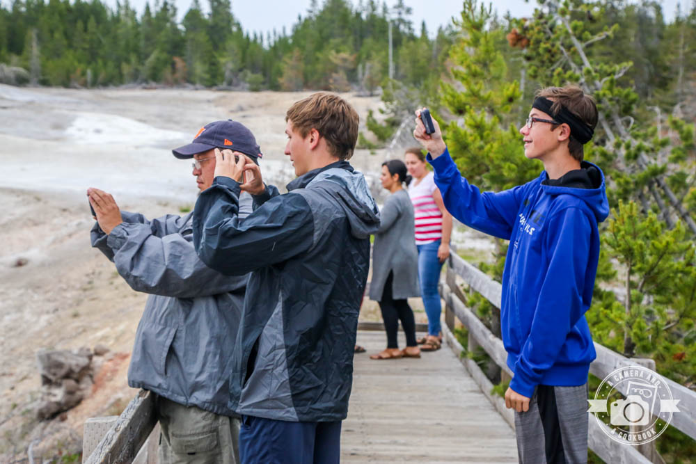
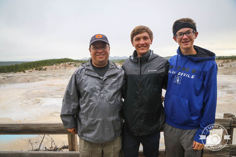
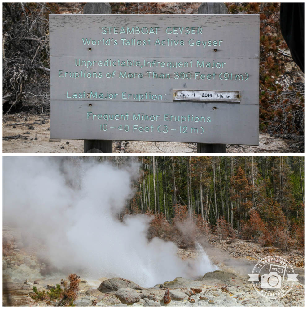
To the left side of the museum is the Back Basin, which is forested and its features are more spread out. Steamboat Geyser is one of the more popular highlights to see. When we were there, there was a park ranger at that stop to answer questions.
Steamboat Geyser is the world’s tallest currently active geyser. This skyscraping geyser has two vents that are 20 feet (6.1 m) apart. The north vent is the taller of the two.
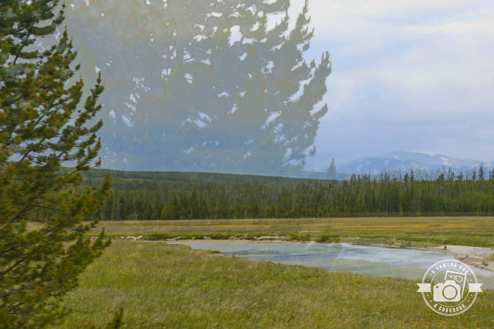
This is an interesting shot. Not sure how I got this what appears to be double exposure, but thought it was noteworthy. 44°43’29.82″ N 110°42’4.644″ W
Here’s a shot along Gibbon River. Looks like a fun area to slide down.
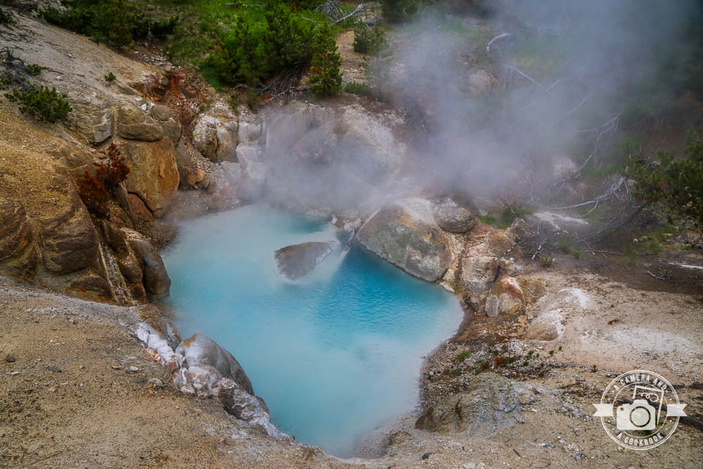
Beryl Spring is a hot spring in the Gibbon Geyser Basin.
Gibbon Falls 44°39’17.352″ N 110°46’14.112″ W
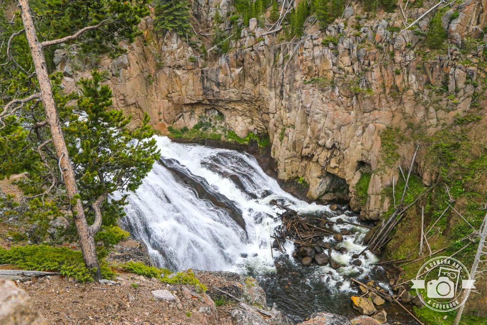
Firehole Falls is 40-foot waterfall running through 800-foot thick lava flows forming the canyon walls. There is a small parking area available near the falls as well as a few pull-offs along the road.

We stopped to get pics of this beautiful creature.
Click >>>> Mountain West Trip:Day in Yellowstone-Part 2 to see Part 2. This is when we hit Fountain Paint Pots Trail, Grand Prismatic Spring, and Old Faithful!
To see all the pics from this day>>>Day in Yellowstone Pics
See full list of posts from this trip>>>Mountain West Trip
Camera Info:
Canon EOS 6D DSLR Camera
Canon EF 24–105mm f/4L IS II USM Lens
Canon PowerShot G7 X Mark II
iPhone 7


What beautiful photos! Heading back to check out your other travel posts. We flew into Colorado last fall and drove up through Wyoming into South Dakota to see Mt. Rushmore and the Badlands then continued on to Nebraska and few home out of Omaha. It was a great trip and so neat to see the plains and the difference in their forests compared to ours on the east coast.